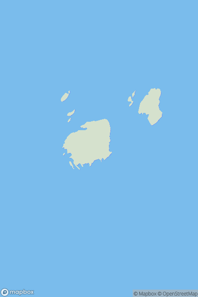
Ariel drone view of mountainous landscape with rolling clouds flowing over peak

Journal your hikes and share your adventures.

Bag peaks across the UK & Ireland, track your progress and see updates from Donder's growing community of hikers.

Donder's profile view available to users after sign-up, shows example user with progress tracking, hiking journal and user leaderboard

Thumbnail image for Bruse Holm showing contour plot for surrounding peak
SCO
Icon of location pin
31m
Icon of vertical, double ended, arrow to symbolise height of mountain

Bruse Holm

Icon of mountain used to symbolise the number of ascents made by users

0
Ascents

Thumbnail image for Clach Criche showing contour plot for surrounding peak
SCO
Icon of location pin
674m
Icon of vertical, double ended, arrow to symbolise height of mountain

Clach Criche

Icon of mountain used to symbolise the number of ascents made by users

0
Ascents

Thumbnail image for Cap of Balnacraig showing contour plot for surrounding peak
SCO
Icon of location pin
211m
Icon of vertical, double ended, arrow to symbolise height of mountain

Cap of Balnacraig

Icon of mountain used to symbolise the number of ascents made by users

0
Ascents

Thumbnail image for Beinnean Dearga showing contour plot for surrounding peak
SCO
Icon of location pin
208m
Icon of vertical, double ended, arrow to symbolise height of mountain

Beinnean Dearga

Icon of mountain used to symbolise the number of ascents made by users

0
Ascents

Thumbnail image for Meall nan Ruaig showing contour plot for surrounding peak
SCO
Icon of location pin
579m
Icon of vertical, double ended, arrow to symbolise height of mountain

Meall nan Ruaig

Icon of mountain used to symbolise the number of ascents made by users

0
Ascents

Thumbnail image for Hill of Cruchie showing contour plot for surrounding peak
SCO
Icon of location pin
144m
Icon of vertical, double ended, arrow to symbolise height of mountain

Hill of Cruchie

Icon of mountain used to symbolise the number of ascents made by users

0
Ascents