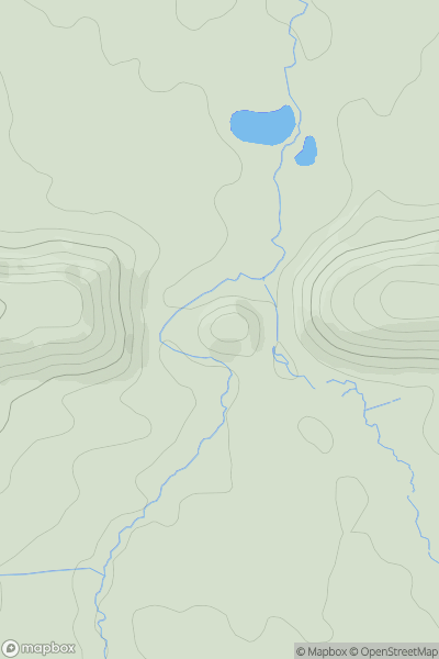
Ariel drone view of mountainous landscape with rolling clouds flowing over peak

Journal your hikes and share your adventures.

Bag peaks across the UK & Ireland, track your progress and see updates from Donder's growing community of hikers.

Donder's profile view available to users after sign-up, shows example user with progress tracking, hiking journal and user leaderboard

Thumbnail image for The Old Pike showing contour plot for surrounding peak
ENG
Icon of location pin
400m
Icon of vertical, double ended, arrow to symbolise height of mountain

The Old Pike

Icon of mountain used to symbolise the number of ascents made by users

0
Ascents

Thumbnail image for Dick Hill showing contour plot for surrounding peak
ENG
Icon of location pin
308m
Icon of vertical, double ended, arrow to symbolise height of mountain

Dick Hill

Icon of mountain used to symbolise the number of ascents made by users

0
Ascents

Thumbnail image for Hodge How showing contour plot for surrounding peak
ENG
Icon of location pin
101m
Icon of vertical, double ended, arrow to symbolise height of mountain

Hodge How

Icon of mountain used to symbolise the number of ascents made by users

0
Ascents

Thumbnail image for Wan Fell showing contour plot for surrounding peak
ENG
Icon of location pin
273m
Icon of vertical, double ended, arrow to symbolise height of mountain

Wan Fell

Icon of mountain used to symbolise the number of ascents made by users

0
Ascents

Thumbnail image for Corfe Castle showing contour plot for surrounding peak
ENG
Icon of location pin
62m
Icon of vertical, double ended, arrow to symbolise height of mountain

Corfe Castle

Icon of mountain used to symbolise the number of ascents made by users

0
Ascents

Thumbnail image for Scoat Fell showing contour plot for surrounding peak
ENG
Icon of location pin
841m
Icon of vertical, double ended, arrow to symbolise height of mountain

Scoat Fell

Icon of mountain used to symbolise the number of ascents made by users

0
Ascents