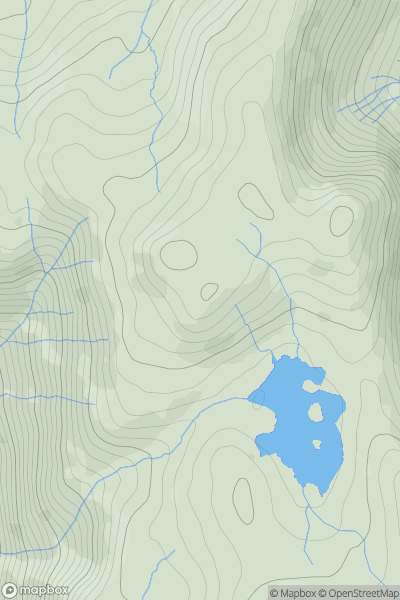
Ariel drone view of mountainous landscape with rolling clouds flowing over peak

Journal your hikes and share your adventures.

Bag peaks across the UK & Ireland, track your progress and see updates from Donder's growing community of hikers.

Donder's profile view available to users after sign-up, shows example user with progress tracking, hiking journal and user leaderboard

Thumbnail image for Heron Pike (Glenridding) showing contour plot for surrounding peak
ENG
Icon of location pin
612m
Icon of vertical, double ended, arrow to symbolise height of mountain

Heron Pike (Glenridding)

Icon of mountain used to symbolise the number of ascents made by users

0
Ascents

Thumbnail image for Windmill Hill [The River Tees to The Wash] showing contour plot for surrounding peak
ENG
Icon of location pin
140m
Icon of vertical, double ended, arrow to symbolise height of mountain

Windmill Hill [The River Tees to The Wash]

Icon of mountain used to symbolise the number of ascents made by users

0
Ascents

Thumbnail image for Rushy Hill [Lancashire, Cheshire and S Pennines] [SD888167] showing contour plot for surrounding peak
ENG
Icon of location pin
317m
Icon of vertical, double ended, arrow to symbolise height of mountain

Rushy Hill [Lancashire, Cheshire and S Pennines] [SD888167]

Icon of mountain used to symbolise the number of ascents made by users

0
Ascents

Thumbnail image for Angletarn Pikes South Top showing contour plot for surrounding peak
ENG
Icon of location pin
565m
Icon of vertical, double ended, arrow to symbolise height of mountain

Angletarn Pikes South Top

Icon of mountain used to symbolise the number of ascents made by users

0
Ascents

Thumbnail image for Maes Knoll showing contour plot for surrounding peak
ENG
Icon of location pin
198m
Icon of vertical, double ended, arrow to symbolise height of mountain

Maes Knoll

Icon of mountain used to symbolise the number of ascents made by users

0
Ascents

Thumbnail image for Rowley's Hill showing contour plot for surrounding peak
ENG
Icon of location pin
51m
Icon of vertical, double ended, arrow to symbolise height of mountain

Rowley's Hill

Icon of mountain used to symbolise the number of ascents made by users

0
Ascents